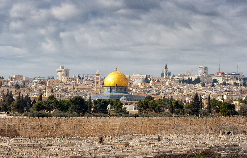
Jerusalem
Jerusalem, Israel’s self-declared capital is perhaps one of the most fascinating and beautiful cities in the world and the holiest city for all three religions of the Holy Book – Islam, Christianity and Judaism.
There are three districts of Jerusalem: the Old City, East Jerusalem and the New City.
The Old City: The major tourist attraction in Jerusalem, both for religious and historical reasons. Dating back 3,000 years, the City is surrounded by fortified walls that house some of the holiest site in Israel. The area known as the Temple Mount is the Western Wall, also known as the Wailing Wall, where Jews pray. On the Noble Sanctuary is the al-Aqsa Mosque and the golden-topped Dome of the Rock, where Muslims Quarter and then the Christian Quarter, is the route Jesus took as he carried his cross to Calvary. Other places to visit are the Pool of Bethesda, a spring-fed pool supposed to possess healing qualities (John 5:2-4). Here Jesus healed a man who had been lame for 38 years (John 5:5-9). The Church of Flagellation is the site where Jesus was flogged.
Walking the streets of the Old City is a memorable experience in itself, with narrow cobbled streets and alleys with market traders on either side. The loud calls of the traders fight for your attention as you meander through the maze of Arab markets losing any sense direction. The smells and sights of herbs and spices, traditional and modern clothes, street food – falafel and shwarma, fresh fruit and vegetables – and the essential gifts of Jerusalem memorabilia add to the ambience. People are friendly and seem to speak the language of every tourist passing, attending to your every need in return for a purchase.
East Jerusalem is home to the Rockefeller Museum, and the Garden Tomb – considered to be a possible site of the crucifixion, burial and resurrection. It is also the site of the Tourjeman Post Museum.
East Jerusalem is a Palestinian district, with small shops, businesses and cheap accommodation, considered an alternative to residing in the Old City.
The New City that surrounds the old one is predominantly Jewish. It is modern and vibrant, offering shops, restaurants and cafes. It is also home to the Knesset building, the Israel Museum and the Holocaust memorial museum of Yad Vashem.
Jerusalem, city of majestic qualities and hospitality.

Avdat National Park
Avdat, also known as Abdah and Ovdat and Obodat, is a site of a ruined Nabataean city in the Negev desert in southern Israel. It was the most important city on the Incense Route after Petra, between the 1st century BCE and the 7th century CEAt this site are the remains of a city that existed for around a thousand years – from the Nabatean period until the Byzantine period. The city spread over a hilltop, standing high above the Tsin Stream. It was named for the Nabatean king Obodas II, who was buried here. When the city was founded it was a waystation on the ancient Incense Route, and it flourished mainly in the Byzantine period. After a strong earthquake in 630 and the Arab conquest of 636, the city fell into decline and was eventually abandoned. Avdat is one of the best-preserved Nabatean cities in Israel. It represents an archeological complex – a city and a well-developed system of ancient agriculture and wells.

Timna
Park Timna, located some 25 km (about 17 miles) north of Eilat, combines beautiful scenery with special antiquities and history and a variety of activities the whole family will enjoy. The horseshoe-shaped valley covers some 60,000 dunams (15,000 acres) and is surrounded by steep cliffs. In the center is Mount Timna, 453 m (about 1500 ft) above sea level. Timna Valley is a geological window revealing a variety of minerals including copper, iron and manganese.
Timna is the site of the world’s first copper mine. Thousands of ancient mining shafts can be seen throughout the park as well as remains of smelting furnaces dating back to ancient imperial Egypt. Copper was the first metal used to create work and household tools, weapons, costly ornaments and cultic objects. You’ll thrill at the stories of Hathor, the goddess of copper, and the deified Pharaoh Ramses. You’ll find remnants of Egyptian mythology and fascinating history. The multimedia presentation “The Mines of Time” brings these stories alive, and explains copper-mining from ancient Egyptian times to the present day.

Mitzpe Ramon
The makhteshim, looking like enormous basins opened up among the Negev ranges, are a natural phenomenon which is unique in the world. The 40-km long Makhtesh Ramon is the largest and most impressive, and visitors are provided a glimpse of the magic and secrets of the desert. As you stand on the rim of the makhtesh, the beautiful and impressive desert scenery is spread out before you. However, it is recommended not just to settle for a wonderful view, but to actually get into it – to go down into the makhtesh, to learn its pathways and unique sites close up and to enjoy the “window” which it opens into the ancient geological worlds of fossils, colorful sands, volcanic rocks, and more.

Mamshit
National Park contains the remains of a Nabatean city from Roman and Byzantine times, and presents Nabatean architecture in all its glory, against the desert backdrop of the northern Negev hills.
The reconstructed city gives the visitor a sense of how Mampsis once looked. Entire streets have survived intact, and there are also large groups of Nabataean buildings with open rooms, courtyards, and terraces. The stones are carefully chiseled and the arches that support the ceiling are remarkably well constructed.
Two churches were discovered in Mampsis. The western St. Nilus Church has a mosaic floor with colourful geometric patterns, birds, a fruit basket, and five dedications in Greek. The eastern church has a lectern on small marble pillars, the remnants of which can be seen at the site. The biggest hoard of treasure ever found in Israel was discovered in Mampsis; 10,500 silver coins, a 72Kg, lead ingot with its foundry markings, a collection of ancient Greek texts on papyrus, and other objects indicative of wealthy people.Mampsis was declared a world heritage site by UNESCO in June 2005.

Beer Sheva
Beersheba is the largest city in the Negev desert of southern Israel. Often referred to as the "Capital of the Negev", it is the center of the fourth-most populous metropolitan area in Israel. The Biblical site of Beersheba is Tel Be'er Sheva, lying some 4 km distant from the modern city, which was established at the start of the 20th century by the Ottoman Turks.
Beersheba has grown considerably since Israel's independence. A large portion of the population is made up of the descendants of Sephardi Jews and Mizrahi Jews who immigrated from Arab countries after 1948, as well as smaller communities of Bene Israel and Cochin Jews from India. Second and third waves of immigration have taken place since 1990, bringing Russian-speaking Ashkenazi Jewish immigrants from the former Soviet Union, as well as Beta Israel immigrants from Ethiopia. The Soviet immigrants have made the game of chess a major sport in Beersheba, and it is now Israel's national chess center, with more chess grandmasters per capita than any other city in the world, making it the chess capital of the world in some regards. Beersheba is home to Ben-Gurion University of the Negev. This city also serves as a center for Israel's high-tech and developing technology industry.

Rahat
Rahat is a Bedouin city in the Southern District of Israel. ] As such, it is the largest Bedouin city in the world, and the only one in Israel to have city status.
Rahat is one of seven Bedouin townships in the Negev desert with approved plans and developed infrastructure. The other six are Hura, Tel as-Sabi (Tel Sheva), Ar'arat an-Naqab (Ar'ara BaNegev), Lakiya, Kuseife (Kseife) and Shaqib al-Salam (Segev Shalom).
The region of the city formerly owned by Al-Tayaha tribe (Al-Hezeel clan). Until the year 1972 the town was called "El Huzaiyil before changing its name. In 1972 Rahat was considered by the government of Israel as a new settlement for Bedouin who lived in the surrounding area without permanent domicile. Until 1980, Rahat was part of the Bnei Shimon Regional Council and from then on (until 1994) it was a local council (administered by a private board until 1989). In 1994 it was recognized as a city – the first Bedouin city in Israel. The city has a total of 33 neighborhoods. All but one of the neighborhoods consist entirely of separate Bedouin clans, but one is a mixed-clan neighborhood. Between each neighborhood there is a wadi. The city also has a market, public and commercial services, neighborhood parks, public areas, women's employment centers, children's play areas, and several mosques.

Tel Sheba
Tel Sheva (in academic contexts) and Tel Be'er Sheva (in popular contexts) are the Hebrew names, and Tell es-Seba the Arabic name of an archaeological site in southern Israel believed to be the remains of the biblical town of Beersheba. It lies east of the modern city of Beersheba and west of the new Bedouin town of Tel Sheva/Tell as-Sabi. Tel Sheva has been preserved and made accessible to visitors in the Tel Be'er Sheva National Park.
Beer-sheba is mentioned 33 times in the biblical text. It is often used when describing a border, such as “from Dan to Beer-sheba” (Judges 20:1; 1 Sam. 3:20; 2 Sam. 3:10, 17:11, 24:2, 24:15; 1 Kings 4:25; 2 Kings 23:8). It is also a significant center in the patriarchal narratives: Abraham dwelt at Beer-sheba (Genesis 22:19), Abraham and Abimelech entered a covenant at Beer-sheba (Genesis 21:32), and Abraham planted a tamarisk tree at Beer-sheba (Genesis 21:33). The Lord spoke to both Isaac and Jacob, Abraham's son and grandson respectively, at Beer-sheba (Genesis 26:23; 46:1).
Beer-sheba is the site of two significant wells: Abraham's well at Beer-sheba was seized by Abimelech's men (Genesis 21:25), and Isaac's servants dug a well at Beer-sheba also (Genesis 26:25).
One of the most significant discoveries at Tel Beer-sheba is that of a horned altar, the first ever unearthed in Israel. Altars with horns at each of their four corners are mentioned frequently in the Bible (Lev. 4:7, 18, 25; Ex. 29:12, 30:2; 38:2; 1 Kings 1:50; 2:28). The altar was not found assembled in situ, but was discovered in secondary use, the stones of the altar been incorporated into a later-date wall.

Tel Arad
Tel Arad is an archaeological tel, or mound, located west of the Dead Sea, about 10 kilometres west of the modern Israeli city of Arad in an area surrounded by mountain ridges which is known as the Arad Plain. The site is divided into a lower city and an upper hill. Tel Arad is one of the most important archaeological sites in Israel, on which were found remains of a fortified Canaanite city of the Early Bronze age with a water facility and a fortified city from the Israelite perion, Iron Age,with a unique temple and fortresses from the time of the Kings of Ju

Qumran
Qumran is primarily known as an archeological site, the place where the Dead Sea Scrolls were found.
In 1963 – 1965 a large archaeological expedition uncovered Herod’s fortress and other buildings, palaces, storerooms and water facilities.
IN 1947, a Bedouin shepherd boy came across the scrolls while trying to retrieve a lost goat. He found them in a cave on a Cliffside stored and protected in years. The scrolls are now on display in the Israel Museum in Jerusalem.
Since the retrieval of the scrolls, excavations in the area have revealed much about the people – the Essenes – who wrote them, including where and how they lived. Ritual baths, a pottery workshop and a cemetery have also been uncovered. The Essences lived in Qumran from about 150 BC until 68 AD, working the land and studying religious texts.
The original home of the Dead Sea Scrolls.

Masada
Masada , the ancient fortress built by King Herod the Great atop a lofty natural plateau overlooking the Dead Sea, was declared a UNESCO World Heritage Site in 2001.
In adding Masada to its prestigious World Heritage List, UNESCO cited several aspects of Masada’s universal value: the site preserves a grand first-century Roman villa, the remains of the most complete Roman siege system in the world, and tells the story of the tragic events leading to the last chapter of the Great Revolt of the Jews against the Romans - the last stand of the rebels who became a symbol of the struggle fight for freedom from oppression.

Hebron
Hebron is a Palestinian city in the southern West Bank, 30 km south of Jerusalem. Nestled in the Judaean Mountains, it lies 930 meters above sea level. The largest city in the West Bank, and the second largest in the Palestinian territories after Gaza, it has a population of 215,452 Palestinians (2016), and between 500 and 850 Jewish settlers concentrated on the outskirts of the Old City of Hebron. Jews, Christians, and Muslims all venerate Hebron for its association with Abraham: it includes the Cave of the Patriarchs, which according to tradition is the burial site of the biblical Patriarchs and Matriarchs.

Bet El
Beit EL is an Israeli settlement and local council located in the Binyamin Region of the West Bank. The Orthodox Jewish town is located in the hills north of Jerusalem, east of the Palestinian city of al-Bireh, adjacent to Ramallah. The biblical Bethel ("House of God") is mentioned in the Bible as the site where Jacob slept and dreamed of angels going up and down a ladder (Genesis 28:19). It is one of the most interesting archeological sites of the Holyland with remains of Jewish city from biblical times as well as one of the oldest mosques in the country together with a crusaders chapel.

Tel Balata
Tel Balata is the site of the remains of an ancient Canaanite/Israelite city located in the Palestinian West Bank. The built-up area of Balata, a Palestinian village and suburb of Nablus, covers about one-third of the tell, and overlooks a vast plain to the east. The Palestinian village of Salim (biblical Salem) is located 4.5 kilometers (2.8 mi) to the east. The site is listed by Unesco as part of the Inventory of Cultural and Natural Heritage Sites of Potential Outstanding Universal Value in the Palestinian Territories Experts estimate that the towers and buildings at the site date back 5,000 years to Chalcolithic and Bronze Age. It is a well excavated city with a wonderful exposed canaate gate.

Sebastia
Sebastia is a Palestinian village of over 4,500 inhabitants, located 12lometers northwest of the city of Nablus, in the Westbank. In the Bible known as Samaria was a central focus point in Israel and is mentioned around 117 times. The word “Samaria” is used 3 different ways in the Bible and can mean: The capital city of Samaria, The geographical region in the hill country north of Jerusalem and The entire Northern Kingdom of Israel. After the nation of Israel was divided in around 936 BC (after Solomon’s reign), the capital of the Northern Kingdom was first established in Shechem and then moved to Tirzah. Both capitals were founded by Jeroboam (931 - 910 BC). King Omri began his reign in 882 BC and moved the capital of the Northern Kingdom from Tirzah and established it in the city of Samaria. It became the second most important city in Israel after Jerusalem. The city sits on a flat-topped, oblong hill with steep slopes on all sides. It was a huge city fortified with walls. King Ahab built a palace at Samaria and overlaid it with ivory (1 Kings 22:39). This palace has been discovered with ivory in it as mentioned in Scripture. Samaria fell to the Assyrians in 722 BC, after 3 years of battle. Samaria was given to Herod the Great by the emperor Augustus. Herod rebuilt Samaria and called it Sebastia in honor of the emperor. In order to honor John the Baptist, a Byzantine church was built on the southern side of the Acropolis in the 5th century. It was believed John’s body was buried here, but this seems quite unlikely according to the evidence. During the Crusader Period (12th century), a church was built on the ruins of the eastern gate. Place of Interests: Western Gate, Colonnade Street, Ahab’s Palace, Temple, Theater, Acropolis, Hippodrome and the church.

Nablus
Nablus
Nablus is a city in the northern West Bank, approximately 49 kilometers north of Jerusalem, with a population of 1267.000. Located between Mount Ebal and Mount Gerizim, it is the capital of the Nablus Governorate and a Palestinian commercial and cultural center, home to An-Najah National University, one of the largest Palestinian institutions of higher learning, and the Palestinian stock-exchange.
The city was named by the Roman emperor Vespasian in 72 CE as Flavia Neapolis. During the Byzantine period, conflict between the city's Christian and Samaritan inhabitants peaked in a series of Samaritan revolts before their suppression in 529 dwindled that community's numbers in the city. With the Muslim conquest in the 7th century, the city was given its present Arabic name Nablus. The Crusaders drafted the laws of the Kingdom of Jerusalem in the Council of Nablus and its Muslim, Christian and Samaritan inhabitants prospered. The city then came under the control of the Ayyubids and Mamluk Sultanate. Under the Ottomans, who conquered the city in 1517, Nablus served as the administrative and commercial center for the surrounding area, corresponding to the present-day northern West Bank.
After the city was captured by British forces during World War I, Nablus was incorporated into the British Mandate of Palestine in 1922. After the 1948 Arab–Israeli War, it came under Jordanian rule together with the rest of the West Bank. Israel has occupied Nablus since the 1967 Six-Day War and since 1995, it has been governed by the Palestinian National Authority. Today, the population is predominantly Muslim, with small Christian and Samaritan minorities.
In the center of Nablus lies the old city, composed of six major quarters: Yasmina, Gharb, Qaryun, Aqaba, Qaysariyya, and Habala. Habala is the largest quarter and its population growth led to the development of two smaller neighborhoods: al-Arda and Tal al-Kreim. The old city is densely populated and prominent families include the Nimrs, Tuqans, and Abd al-Hadis. The large fortress-like compound of the Abd al-Hadi Palace built in the 19th century is located in Qaryun. The Nimr Hall and the Tuqan Palace are located in the center of the old city. There are several mosques in the Old City: The Great Mosque of Nablus, An-Nasr Mosque, al-Tina Mosque, al-Khadra Mosque, Hanbali Mosque, al-Anbia Mosque, Ajaj Mosque and others
There are six hamaams (Turkish baths) in the Old City, the most prominent of them being al-Shifa and al-Hana. Al-Shifa Hamaam was built by the Tuqans in 1624. Al-Hana in Yasmina was the last hamaam built in the city in the 19th century. It was closed in 1928 but restored and reopened in 1994.[8] Several leather tanneries, souks, pottery and textile workshops line the Old City streets.[42][45] There are a number of historic monuments in the old city including the Khan al-Tujjar and the al-Manara Clock Tower built in 1906.
Nablus is one of the Palestinian cities that sustained elite classes, fostering the development of a culture of "high cuisine", such as that of Damascus or Baghdad. The city is home to a number of food products well known throughout the Levant, the Arab world and the former provinces of the Ottoman Empire.
Kanafeh (or Kunafa) is the best known Nabulsi sweet. It is made of several fine shreds of pastry noodles with honey-sweetened cheese in the center. The top layer of the pastry is usually dyed orange with food coloring and sprinkled with crushed pistachios. Now made throughout the Middle East, kanafeh Nabulsi uses a white-brine cheese called jibneh Nabulsi. Boiled sugar is used as a syrup for kanafeh.
Other sweets made in Nablus include baklawa, "Tamriya", mabrumeh and ghuraybeh, a plain pastry made of butter, flour and sugar in an "S"-shape, or shaped as fingers or bracelets.

Bethlehem
The "little town" of Bethlehem, mentioned in Christmas carols, attracts pilgrims worldwide on account of its description in the New Testament (and particularly the Gospels) as the Biblical birthplace of Jesus, whom Christians believe to be Messiah and Son of God. The Church of the Nativity, one of the oldest churches in the world, is the focus of Christian veneration within the city.
Bethlehem is also revered by Jews and Muslims as the birthplace and home town of David, Biblical prophet and King of Israel, as well as the traditional site of Rachel's Tomb (on the outskirts of the town).
Although also home to many Muslims, Bethlehem r
A long snake of town, the main thoroughfare of Bethlehem is Manger Street which stretches from Rachel's Tomb (and the road to Jerusalem) all the way to Manger Square, the focal point of the city. Manger Square is flanked by the Church of the Nativity on one side and the Mosque of Omar on the other. The Old Town and the souq (market), which are best navigated on foot, stretch up the hill from Manger Square.
The name means "The House of Bread" in Hebrew, and "The House of Meat" in Arabic. However, it seems likely that both meanings have been retrofitted onto what was originally the House of Lachma, the Mesopotamian god of fertility. The area has been settled since 5,000 BC and there is some evidence that the town is mentioned in the Egyptian Amarna letters (1400 BC). The Old Testament Book of Ruth (c. 1150 BC) has the first certain reference to Bethlehem; it tells the story of Naomi, who left Bethlehem during a famine, and later returned with her daughter-in-law Ruth. Still, Bethlehem remained a small town in the shadow of mighty Jerusalem, and according to most estimates it had some 300 to 1000 inhabitants at the time of the event that gave Bethlehem its fame, namely the birth of Jesus.
Many sites of Bethlehem are within foot-reach: The Church of the Nativity (From the last bus stop walk left through Pope Paul VI street until Manger Square. It's all straight, just make sure to take a left at the Lutheran church.). Undoubtedly the top attraction in Bethlehem, a veritable citadel built fortress-like on top of the cave where Jesus was born to Mary. It is one of the oldest churches in the world, and has been inscribed on the UNESCO World Heritage List. The first incarnation of the building was erected on the orders of the Roman Emperor Constantine I (the Great) in 330 CE. While the layout largely corresponds to Emperor Justinian's plans from 540 CE (the first building having been destroyed in a 536 riot), the church was first heavily fortified by the Crusaders and then degraded (mostly through neglect) under Mamluk rule. An earthquake in 1834 and a fire in 1869 didn't help. Today, the structure is mostly sound but somewhat dark and gloomy in appearance, only the adjoining Franciscan Church of St Catherine (dated 1881 and the site of the yearly December 24 midnight mass broadcast around the world) being in excellent shape. The alleged site of Jesus' birth is actually in an cave in the church (the original Manger where Jesus was born was a cave, not a shed, as popularly depicted). There is a star marking the exact location of Jesus' birth in the cave. The original Manger with the star marking Jesus' birth site is called the Grotto of the Nativity, and is accessible from inside the church. (The tomb of famed theologian and Bethlehem resident St. Jerome, who spent his life translating the Bible, is also in the cave with the Grotto.) Entrance to the entire complex is free, but in the high season (and especially on Jan 6th) be prepared for massive crowds and hour-long waits for entry into the Grotto. There are usually accredited but dodgy tour-guides waiting at the entrance or inside of the church who offer to give tours to groups/individuals, sometimes allowing you to skip the crowds. Makes sure to agree on a price before taking the tour, and if the promise was to skip the crowds and get into the crotto directly but not possible sometimes, lower the price by at least half. Otherwise do not support them, as it is unfair to the other visitors waiting. Rachel's Tomb (Separated from Bethlehem by the wall). Burial place of the matriarch Rachel, wife of Jacob and mother of Joseph and Benjamin is the second most important historical site in Bethlehem. (Genesis 35:19-20). It is a holy site in Judaism, Christianity and Islam. As a result of the security situation, the Tomb's original structure has been surrounded by an Israeli fortress, barricading it off from Bethlehem. While the original tomb can still be seen in its entirety from within the fortress, access to the tomb is now only possible by vehicle. The Shepherds' Fields. "While shepherds watched their flocks by night..." - rival locations in the Bethlehem suburb of Beit Sahour claim to be the site of the angel's visitation to the shepherds mentioned in the Gospels. The Milk Grotto Chapel. Where Mary supposedly spilled a few drops of breast milk while feeding Jesus as she hid before the Holy Family's escape to Egypt, turning the cavern milky white. It is open all day. The white powder scrapped from the cave is also sold as a fertility medicine inside the chapel. The Mosque of Omar. A mosque built in 1860 in active use. Rather plain and uninteresting on the inside but somewhat pretty on the outside. The Solomon's Pools. Three huge Herodian-era stone carved reservoirs capable of holding 160,000 m³ of water. They are located in a pine tree forest about 3 km from Bethlehem in a beautiful hiking area called the Artas Valley. In Artas, there is also the very beautiful Italian Order of the Sisters of Mary of the Garden built the Hortus Conclusus Convent and as well a Palestinian Folklore museum. Artas village also boasts an annual lettuce festival.

Ashdod
Ashdod has a long history, and was inhabited in the times of the Bible by the Philistines. When the Philistines captured the Ark of the Covenant from the Israelites, they brought it here before being forced to return it. However, few traces remains nowadays of the ancient city.
Modern Ashdod is known for its diverse population, with each wave of Jewish immigration represented. Jews from former Soviet Union makes up roughly a third of total 235,000 residents. The city is also home to large numbers of Moroccan, Georgian, Ethiopian and recently, French and Argentinian Jews. It also has the third largest charedi (ultra-Orthodox) religious population in Israel, after Jerusalem and Bnei Brak.
Ashdod is on the meeting point of the yellow sand dunes from the south, the green lowland from the east (including the small Lachish river), and the blue Mediterranean Sea from the west. Therefore you can find a surprising diversity of natural sights in one city.
The city is a young one, re-founded 50 years ago and grown dramatically during the last two decades. It is well planned and maintained, and its beaches and south regions are very beautiful. It regularly finds itself in highest places in rankings of the most beautiful/well designed cities in Israel.
What to see:
· The southern beach area is home to a Fatimid fortress from the Crusader period, located several meters from the coastline. The site is guarded by local police and entirely fenced.
· The whole southern and near-beach area has beautiful and quiet villas.
· Giv'at Yonah (Jonah's Hill) is named after the prophet Jonah, who is believed to be buried there. It is the highest point of the city (around 150 m above sea level) with the city lighthouse on top of it.
· A few hundreds meters away, Lachish Park (named after the Lachish river) can be found, with some wildlife and plenty sea birds.
· The only sand dunes in central Israel are located in the national reserve between southeast Ashdod and highway 4 (the road to Tel Aviv). The largest dune is about 35 meters high and 250 meters long. In the reserve there is also preserved wildlife (mostly deer, rabbits, birds and jackals). Entrance is free.
· Ad H'alom Memorial Park (lit. No-Further Memorial Park), (East Ashdod, near the southern entrance to the city by road no' 4). open area. During the 1948 Israel Independence War, the Egyptian army invaded Israel. This park marks the northernmost point they reached before being forced to retreat by Israeli forces. free. edit
· The Korin Maman Museum has a permanent archeology exhibition called "Philistian World" as well as various changing art exhibitions.
· Ashdod Museum of Art located in the MonArt center, has 13 exhibition halls. In an architectural echo of the Louvre, the entrance to the museum is through a glass pyramid.
Ashdod has a pretty, long coast (8 km/6 miles) with several public beaches and a marina accessible for the public. Ashdod's beach strip is about 2/3 the length of Tel Aviv's, yet it serves only about tenth population compared to the latter. Since it's not crowded or very touristic, it's a great place for a calm trip of wondering between villas or by the beach.
There is horse riding, 4X4 rental, and the city marina provides yacht/cruise services.
Ashdod is home to the Israeli Andalusian Orchestra which performs music originating in Andalusia, a blend of Western and Arabic music.
The MonArt center is a performing arts center which has different art schools, studios and events.

Qasr el Yahud
Christian tradition marks this site as the place of the “spiritual birth” of Jesus, as opposed to his physical birth in Bethlehem. As such, the baptismal site is of great sacred significance – the third holiest site in the Christian world (after the Church of the Nativity in Bethlehem and the Church of the Holy Sepulchre in Jerusalem).

Tel Aviv
Tel Aviv, Israel’s largest metropolitan area, serves as a hub for innovation, culture and creativity. “Tel Aviv Nonstop City” is more than just a slogan. With the city’s beautiful beaches, diverse cultural scene, top-notch cuisine, and vibrant nightlife, there’s always something to see and do here. The city serves as a meeting point between old and new, reflecting tradition and history while embracing innovation, pluralism and diversity. Here you can be whoever you want to be - whether you’re a party-goer, culture enthusiast, or just like to chill.
The city was founded in 1909 by the Yishuv (Jewish residents) as a modern housing estate on the outskirts of the ancient port city of Jaffa, then part of the Mutasarrifate of Jerusalem within the Ottoman Empire. It was at first called 'Ahuzat Bayit'the name of the association which established the neighborhood. Its name was changed the following year to 'Tel Aviv', after the biblical name Tel Abib adopted by Nahum Sokolow as the title for his Hebrew translation of Theodor Herzl's 1902 novel Altneuland ("Old New Land").
Known as The White City, The Bauhaus architecture was introduced in the 1920s and 1930s by German Jewish architects who settled in Palestine after the rise of the Nazis. Tel Aviv's White City, around the city center, contains more than 5,000 Modernist-style buildings inspired by the Bauhaus school and Le Corbusier. Construction of these buildings, later declared protected landmarks and, collectively, a UNESCO World Heritage Site, continued until the 1950s in the area around Rothschild Boulevard. Some 3,000 buildings were created in this style between 1931 and 1939 alone. In the 1960s, this architectural style gave way to office towers and a chain of waterfront hotels and commercial skyscrapers. Some of the city's Modernist buildings were neglected to the point of ruin. Before legislation to preserve this landmark architecture, many of the old buildings were demolished. Efforts are under way to refurbish Bauhaus buildings and restore them to their original conditiTel Aviv is a major center of culture and entertainment. Eighteen of Israel's 35 major centers for the performing arts are located in the city, including five of the country's nine large theatres, where 55% of all performances in the country and 75 percent of all attendance occurs.
Tel Aviv is an international hub of highly active and diverse nightlife with bars, dance bars and nightclubs staying open well past midnight. The largest area for nightclubs is the Tel Aviv port, where the city's large, commercial clubs and bars draw big crowds of young clubbers from both Tel Aviv and neighboring cities. The South of Tel Aviv is known for the popular Haoman 17 club, as well as for being the city's main hub of alternative clubbing, with underground venues including established clubs like the Block Club, Comfort 13 and Paradise Garage, as well as various warehouse and loft party venues. The Allenby/Rothschild area is another popular nightlife hub, featuring such clubs as the Pasaz, Radio EPGB and the Penguin. In 2013, Absolut Vodka introduced a specially designed bottle dedicated to Tel Aviv as part of its international cities series.
Named "the best gay city in the world" by American Airlines, Tel Aviv is one of the most popular destinations for LGBT tourists internationally, with a large LGBT community. The city hosts its well-known pride parade, the biggest in Asia, attracting over 200,000 people yearly.[ In January 2008, Tel Aviv's municipality established the city's LGBT Community centre, providing all of the municipal and cultural services to the LGBT community under one roof. In December 2008, Tel Aviv began putting together a team of gay athletes for the 2009 World Outgames in Copenhagen. In addition, Tel Aviv hosts an annual LGBT Film festival
Tel Aviv is famous for its wide variety of world-class restaurants, offering traditional Israeli dishes as well as international fare. More than 100 sushi restaurants, the third highest concentration in the world, do business in the city. In Tel Aviv there are some dessert specialties, the most known is the Halva ice cream traditionally topped with date syrup and pistachios
Israel has the highest number of museums per capita of any country, with three of the largest located in Tel Aviv. Among these are the Eretz Israel Museum, known for its collection of archaeology and history exhibits dealing with the Land of Israel, and the Tel Aviv Museum of Art. Housed on the campus of Tel Aviv University is Beit Hatfutsot, a museum of the international Jewish diaspora that tells the story of Jewish prosperity and persecution throughout the centuries of exile. Batey Haosef Museum specializes in Israel Defense Forces military history. The Palmach Museum near Tel Aviv University offers a multimedia experience of the history of the Palmach. Right next to Charles Clore Park is a museum of the Irgun. The Israel Trade Fairs & Convention Center, located in the northern part of the city, hosts more than 60 major events annually. Many offbeat museums and galleries operate in the southern areas, including the Tel Aviv Raw Art contemporary art gallery.

Jaffa
The walled city of Jaffa was the only inhabited part of what is now Tel Aviv in early modern times. Jaffa was an important port city in the region for millennia. Archaeological evidence shows signs of human settlement there starting in roughly 7,500 BC. The city was established around 1,800 BC at the latest. Its natural harbour has been used since the Bronze Age. By the time Tel Aviv was founded as a separate city during Ottoman rule of the region, Jaffa had been ruled by the Canaanites, Egyptians, Philistines, Israelites, Assyrians, Babylonians, Persians, Phoenicians, Ptolemies, Seleucids, Hasmoneans, Romans, Byzantines, the early Islamic caliphates, Crusaders, Ayyubids, and Mamluks before coming under Ottoman rule in 1515. It had been fought over numerous times. The city is mentioned in ancient Egyptian documents, as well as the Hebrew Bible.For the Christian visitor to Tel Aviv, what is arguably the most significant reference to Jaffa is the Vision of St. Peter (Acts 10: 1-48). As it is written (10-15): The traditional site of this vision is reached by descending the stairs down to the port, to Simtat Shimon Habourskai (Simon the Tanner Lane) and continuing until the entryway to the building, marked by a sign indicating that this is the House of Simon the Tanner. St. Peter was Simon’s guest, and it was while staying here, the Acts of the Apostles relates, that Simon had a vision in which he was instructed to proselytize among the non-Jews, too. For many years this house and courtyard have belonged to members of the Zacharian family, who also guard the lighthouse in the courtyard, which lights the way for Jaffa’s fishermen. “And he [Simon Peter] became very hungry and would have eaten; but while they made ready, he fell into a trance. And saw heaven opened, and a certain vessel descending unto him, as it had been a great sheet knit at the four corners, and let down to the earth. Wherein were all manner of four-footed beasts of the earth and wild beasts and creeping things, and fowls of the air. And there came a voice to him. Rise Peter; kill and eat. And the voice spake unto him again the second time. What God hath cleansed, that call not thou common.” This vision, central to the universality of the Christian gospel, took place in Jaffa, on the roof of the house belonging to Simon the Tanner, which for the past 800 years has been the focus of pilgrimage visits to the Holy Land. A picturesque building stands on the site of Simon the Tanner’s original house, overlooking the lighthouse, but for judicial reasons it is closed to visitors and can only be viewed from outside. Another important Christian landmark in Jaffa is the site of the building - a church for many centuries - where St. Paul was jailed before being released to Rome, to stand trial. Not a part of Jaffa, technically speaking, but adjacent to it, and of great interest to Christian visitors, is the grave of Tabitha in South Tel Aviv. As it is written in Acts 9: 36- 42, Peter was summoned from Lydda (modern-day Lod) to Jaffa, upon the death of Tabitha, known far and wide for her charitable works: “But Peter…kneeled down, and prayed: and turning him to the body said, Tabitha, arise. And she opened her eyes; and when she saw Peter, she sat up. And he gave her his hand, and lifted her up, and when he had called the saints and widows, presented her alive. And it was known throughout all Joppa [Jaffa]; and many believed in the Lord.” (40-42). Jaffa also has a place in Greek mythology. According to legend it was on the rock off Jaffa’s shore that the beau tiful Andromeda was chained by Poseidon but was subsequently rescued by Perseus. Andromeda’s Rock can still be seen in the Old Jaffa Port, as well as a bronze statue of the lovely Greek maiden. Other ancient sites in Tel Aviv include: Tell Qasile, Tel Gerisa, Abattoir hill. Tel Hashash and Tell Qudadi.

Beit Shean
Beit She'an, historically known as Scythopolis is ancient city at the Northern District of Israel, which has played an important role in history due to its geographical location at the junction of the Jordan River Valley and the Jezreel Valley. In the Biblical account of the battle of the Israelites against the Philistines on Mount Gilboa, the bodies of King Saul and three of his sons were hung on the walls of Beit She'an (1 Samuel 31:10-12). In Roman times, Beit She'an was the leading city of the Decapolis, a league of pagan cities. In modern times, Beit She'an serves as a regional centre for the settlements in the Beit She'an Valley.
The ancient city ruins are now protected within the Beit She'an National Park.
In 63 BCE, Pompey made Judea a part of the Roman empire. Beit She'an was refounded and rebuilt by Gabinius. The town center shifted from the summit of the mound, or tell, to its slopes. Scythopolis prospered and became the leading city of the Decapolis, the only one west of the Jordan River.
The city flourished under the "Pax Romana", as evidenced by high-level urban planning and extensive construction, including the best preserved Roman theatre of ancient Samaria, as well as a hippodrome, a cardo and other trademarks of the Roman influence. Mount Gilboa, 7 km (4 mi) away, provided dark basalt blocks, as well as water (via an aqueduct) to the town. Beit She'an is said to have sided with the Romans during the Jewish uprising of 66 CE.[ Excavations have focused less on the Roman period ruins, so not much is known about this period.
Copious archaeological remains were found dating to the Byzantine period (330–636 CE) and were excavated. A rotunda church was constructed on top of the Tell and the entire city was enclosed in a wall. Textual sources mention several other churches in the town. Beit She'an was primarily Christian, as attested to by the large number of churches, but evidence of Jewish habitation and a Samaritan synagogue indicate established communities of these minorities. The pagan temple in the city centre was destroyed, but the nymphaeum and Roman baths were restored. Many of the buildings of Scythopolis were damaged in the Galilee earthquake of 363, and in 409 it became the capital of the northern district, Palaestina Secunda. As such, Scythopolis (v.) also became the Metropolitan archdiocese of the province.
Dedicatory inscriptions indicate a preference for donations to religious buildings, and many colourful mosaics, such as that featuring the zodiac in the Monastery of Lady Mary, or the one picturing a menorah and shalom in the House of Leontius' Jewish synagogue, were preserved. A Samaritan synagogue's mosaic was unique in abstaining from human or animal images, instead utilising floral and geometrical motifs. Elaborate decorations were also found in the settlement's many luxurious villas, and in the 6th century especially, the city reached its maximum size of 40,000 and spread beyond its period city wall.
The Byzantine period portion of the northern cemetery was excavated in 1926. The tombs from this period consisted of small rock-cut halls with vaulted graves on three sides. A great variety of objects were found in the tombs, including terracotta figurines possibly depicting the Virgin and Child, many terracotta lamps, glass mirrors, bells, tools, knives, finger rings, iron keys, glass beads, bone hairpins, and many other items.
In 634, Byzantine forces were defeated by the Muslim army of Caliph Umar ibn al-Khattab and the city reverted to its Semitic name, being named Baysan in Arabic. The day of victory came to be known in Arabic as Yawm Baysan or "the day of Baysan." The city was not damaged and the newly arrived Muslims lived together with its Christian population until the 8th century, but the city declined during this period. Structures were built in the streets themselves, narrowing them to mere alleyways, and makeshift shops were opened among the colonnades. The city reached a low point by the 8th century, witnessed by the removal of marble for producing lime, the blocking off of the main street, and the conversion of a main plaza into a cemetery.[ However, some recently discovered counter-evidence may be offered to this picture of decline. In common with state-directed building work carried out in other towns and cities in the region during the 720s, Baysan's commercial infrastructure was refurbished: its main colonnaded market street, once thought to date to the sixth century, is now known—on the basis of a mosaic inscription—to be a redesign dating from the time of the Umayyad caliph Hisham (r. 724–43), Abu Ubayd al-Andalusi noted that the wine produced there was delicious.
On January 18, 749, Umayyad Baysan was completely devastated by a catastrophic earthquake. A few residential neighborhoods grew up on the ruins, probably established by the survivors, but the city never recovered its magnificence. The city center moved to the southern hill where later the Crusaders built their castle.
Jerusalemite historian al-Muqaddasi visited Baysan in 985, during Abbasid rule and wrote that it was "on the river, with plentiful palm trees, and water, though somewhat heavy (brackish.)" He further noted that Baysan was notable for its indigo, rice, dates and grape syrup known as dibs. The town formed one of the districts (kurah) of Jund al-Urdunn during this period. Its principal mosque was situated in the center of its marketplace.
In the Crusader period, the Lordship of Bessan was occupied by Tancred in 1099; it was never part of the Principality of Galilee, despite its location, but became a royal domain of the Latin Kingdom of Jerusalem in 1101, probably until around 1120. According to the Lignages d'Outremer, the first Crusader lord of Bessan once it became part of the Kingdom of Jerusalem was Adam, a younger son of Robert III de Béthune, peer of Flanders and head of the House of Bethune. His descendants were known by the family name de Bessan
A small Crusader fortress surrounded by a moat was built in the area southeast of the Roman theatre, where the diminished town had relocated after the 749 earthquake. The fortress was destroyed by Saladin in 1183.
During the 1260 Battle of Ain Jalut, retreating Mongol forces passed in the vicinity but did not enter the town itself.
Under Mamluk rule, Beit She'an was the principal town in the district of Damascus and a relay station for the postal service between Damascus and Cairo. It was also the capital of sugar cane processing for the region. Jisr al-Maqtu'a, "the truncated/cut-off bridge", a bridge consisting of a single arch spanning 25 feet and hung 50 feet above a stream, was built during that period.

Mount Carmel
Mount Carmel is a coastal mountain range in northern Israel stretching from the Mediterranean Sea towards the southeast. The range is a UNESCO biosphere reserve. A number of towns are situated there, most notably the city of Haifa, Israel's third largest city, located on the northern and western slopes.
In mainstream Jewish, Christian, and Islamic thought, Elijah is indelibly associated with the mountain, and he is regarded as having sometimes resided in a grotto on the mountain. Indeed, one Arabic name for Mount Carmel is . "Mount of Saint Elias". In the Books of Kings, Elijah challenges 450 prophets of Baal to a contest at the altar on Mount Carmel to determine whose deity was genuinely in control of the Kingdom of Israel. As the narrative is set during the rule of Ahab and his association with the Phoenicians, biblical scholars suspect that the Baal in question was probably Melqart.
According to chapter 18 of the Book of Kings in the Hebrew Bible, the challenge was to see which deity could light a sacrifice by fire. After the prophets of Baal had failed, Elijah had water poured upon his sacrifice to saturate the altar. He then prayed. Fire fell and consumed the sacrifice, wood, stones, soil and water, which prompted the Israelite witnesses to proclaim, "The LORD, He is God! The LORD, He is God!" In the account, Elijah also announced the end to a long three-year drought, which had previously been sent as divine punishment for Israel's idolatry.
Though there is no biblical reason to assume that the account of Elijah's victory refers to any particular part of Mount Carmel, Islamic tradition places it at a point known as El-Maharrakah or rather El-Muhraqa, meaning the burning.
Two areas have been hypothesized as the possible site for the story about the battle against the priests of Baal. The slaughter could have taken place near the river Kishon, at the mountain base, in an amphitheater-like flat area. The site where the offering took place is traditionally placed on the mountain above Yokneam, on the road to the Druze village of Daliyat el-Karmil, where there is a monastery, built in 1868, called El-Muhraqa ("the burning", possibly related to the burnt sacrifice"). It is regarded as one of the must-visit tour sites in the area of Haifa.
Although archaeological clues are absent, the site is favored because it has a spring, from which water could have been drawn to wet Elijah's offering. There is also a sea view, where Elijah looked out to see the cloud announcing rain. However, the biblical text states that Elijah had to climb up to see the sea. There is an altar in the monastery which is claimed to be that which Elijah built in God's honor, but that is unlikely, as it's not made of the local limestone.

Zippori
In Late Antiquity, it was believed to be the birthplace of Mary, mother of Jesus, and the village where Saints Anna and Joachim are often said to have resided, where today a 5th-century basilica is excavated at the site honouring the birth of Mary.[6] Notable structures at the site include a Roman theatre, two early Christian churches, a Crusader fort partly rebuilt by Zahir al-Umar in the 18th century, and over sixty different mosaics dating from the third to the sixth century CE.Following the Bar Kokhba revolt of 132–135, Sepphoris was one of the Galilean centers where rabbinical families from Judea relocated. Remains of a synagogue dated to the first half of the fifth century were discovered on the northern side of town. In the 7th century, the town was conquered by the Arab Rashidun armies during the Muslim conquest of the Levant. Successive Muslim dynasties ruled the area until the Crusades.
Until its depopulation during the 1948 Arab–Israeli War, Saffuriya was an Arab village. Moshav Tzippori was established adjacent to the site in 1949. It falls under the jurisdiction of Jezreel Valley Regional Council, and in 2019 had a population of 972.
In 1992, the area occupied until 1948 by the Arab village, where the remains of the ancient city have been excavated, was designated an archaeological reserve named Zippori National Park.
· The Theater – a reconstructed remnant of a Roman theater, unique in the country. The 4,500-seat theater, built at the end of the first century CE, is carved out of the rocky slope, and provides a view of the Bet Netofa Valley and the hills of Upper Galilee. Musical and vocal performances are given here from time to time.
· The Jewish Quarter – remains of a Jewish residential quarter from the time of the Mishna and Talmud. The quarter has been reconstructed and one can wander around its alleyways. In light of the many ritual baths, it is assumed that members of the “Yedaiah” Priestly Division lived here.
· The Crusader Castle – the castle was built in the Crusader period on top of the remains of an earlier structure, and from here the Crusader force departed for the battle at Hittin in 1187. The castle contains an exhibit of findings and tablets telling the history of the city and the excavations. There is a guided lookout on the roof.
· Dionysus House – a Roman villa, containing a mosaic floor describing scenes from the life of Dionysus, god of wine in Greek mythology. This impressive mosaic shows the image of a woman, nicknamed “the Mona Lisa of the Galilee”. In the opinion of many researchers, it is the pinnacle of mosaic art in the country.
Nile Festival House – a public area from the Byzantine period, decorated with 11 mosaic floors describing the celebrations held in honor of the Nile’s rise to its highest level.
- The Theater – a reconstructed remnant of a Roman theater, unique in the country. The 4,500-seat theater, built at the end of the first century CE, is carved out of the rocky slope, and provides a view of the Bet Netofa Valley and the hills of Upper Galilee. Musical and vocal performances are given here from time to time.
· The Ancient Reservoir – an impressive, 260 m. long underground water facility, which was in operation from the Roman period up to the 7th century. Walking inside the reservoir, deep below surface level, is a unique experience. Close to the reservoir is the 6-shaft tunnel.
· The Synagogue – a long narrow basilica-like structure, dated to the end of the Byzantine period, containing an impressive mosaic floor divided into four parts: the Sacrifice of Isaac, the signs of the Zodiac, a description of the Tabernacle in the desert and the Arc of the Covenant in the Jerusalem Temple.
· Streets Layout – the remains of the intersection between the Cardo and the Decumanus were exposed on the site. The paving stones of the Cardo clearly show the longitudinal grooves caused by the wheels of the carts that travelled over them for many years. These streets formed part of the city market.

Katzrin
Katzrin is an Israeli settlement organized as a local council in Golan Heights.Known as the "capital of the Golan," it is the second-largest locality there after Majdal Shams, and the largest Jewish locality. It is the seat of Golan Regional Council.
To the south of Katzrin is the Sea of Galilee, to the north Mount Hermon, and to the west are the Upper Galilee hills of Israel.
The Ancient Katzrin Park: To get a sense of life during the Talmudic period (3rd to 6th centuries) when the Golan had dozens of Jewish villages, drop by this partly reconstructed Byzantine-era village. In August and on Jewish holidays such as Passover and Sukkot, there are re-enactments by actors in period costumes. Fresh pitas are often available at the beit lehem (bread house). Wheelchair accessible. Situated 1.6km east of the Merkaz Eitan commercial centre.
Highlights include a basalt synagogue, a working olive-oil press, an audiovisual presentation (with air-con!) on the deliberations of Talmudic luminaries (not shown on Saturday) and free-range peacocks.

Mount Tabor
Mount Tabor is located in Lower Galilee, Israel, at the eastern end of the Jezreel Valley, 18 kilometres west of the Sea of Galilee. In the Hebrew Bible (Joshua, Judges), Mount Tabor is the site of the Battle of Mount Tabor between the Israelite army under the leadership of Barak and the army of the Canaanite king of Hazor, Jabin, commanded by Sisera. In Christian tradition, Mount Tabor is the site of the transfiguration of Jesus.
Between 1919 and 1924 a Roman Catholic church of the Franciscan order named "Church of the Transfiguration" was built on the peak of Mount Tabor. The architect who designed the church was Antonio Barluzzi. The church was built upon the ruins of a Byzantine church from the fifth or sixth century and a Crusader church from the 12th century. In the upper part of the church, above the altar, is a mosaic which depicts the Transfiguration. On the Feast of the Transfiguration, celebrated on August 6, it is illuminated by sunbeams which are reflected by a glass plate on the floor of the church. A rock near the entrance of the church has an engraving in ancient Greek and beside it there is an engraving of a cross. Nearby there are the remains of the 12th-century Benedictine abbey.
There is also a Greek Orthodox monastery, that is dedicated as the catholic one , to the Transfiguration. The construction was started by a Romanian monk, Irinarh Rosetti, in 1859, the year of his death, and finished by his disciple, Nectarie Banul, in 1862.Northeast of the Church of the Transfiguration is the Church of the Prophet Elijah. Northwest of the main church is a small cave-church named after Melchizedek, the King of Salem. According to the Christian tradition, this cave was the place where Abraham met the king of Salem.The cave was known to pilgrims and local Christians during the Middle Ages. An all-night vigil is held at the church every year on the Orthodox Feast of the Transfiguration.

Gamla
The Gamla nature reserve has a rare combination, both nature and scenery and a fascinating historical human story. Located in the Golan Heights don´t miss the following points of interest:
The observation terrace – a view from above of the ancient town of Gamla and the remains of the early synagogue. From the terrace, a steep path leads down to the old town, accessible to good walkers.
Touring the ruins of the ancient town of Gamla – a narrow road has recently been inaugurated, making it possible to reach the ruins of the ancient town by bus.
Lookout point – looking out over the cliffs of the Gamla Stream canyon and the nesting colony of birds of prey.
The head of the Gamla Stream waterfall – the highest waterfall in Israel (51 m) flowing all year round. An easy path leads to the lookout terrace, from which the waterfall can be seen in all its glory.
Dolmens – a collection of Bronze Age burial mounds made of huge boulders.

Megiddo
Tel Megiddo is the site of the ancient city of Megiddo, the remains of which form a tell (archaeological mound), situated in northern Israel near Kibbutz Megiddo, about 30 km south-east of Haifa. Megiddo is known for its historical, geographical, and theological importance, especially under its Greek name Armageddon. During the Bronze Age, Megiddo was an important Canaanite city-state and during the Iron Age, a royal city in the Kingdom of Israel. Megiddo drew much of its importance from its strategic location at the northern end of the Wadi Ara defile, which acts as a pass through the Carmel Ridge, and from its position overlooking the rich Jezreel Valley from the west. Excavations have unearthed 26 layers of ruins since the Chalcolithic phase, indicating a long period of settlement.The site is now protected as Megiddo National Park and is a World Heritage Site.
The Canaanite period
The city gate and Canaanite palace: The main find from the Canaanite period are the city gate (15th century BCE), and the original stone paving from the period that leads to it. Alongside it is the Canaanite palace – the remains of a vast structure of rooms built around a central courtyard. In one of the rooms, spectacular items were found, including gold objects, hundreds of pieces of decorated ivory jewelry, and a washroom paved with shells.
The temple area: An interesting site in the “large section” excavated by the early archaeological expeditions at Megiddo. In this area, the earliest remains of the site were found. The temples were used as a ritual site for some 2000 years, until settlement by the Israelites (12th century BCE). In the large section, which was excavated down to the bedrock, more than 20 layers of settlement were found.
“The Aegean Tomb”: In Gottlieb Schumacher’s excavations, a pit was found above the temple area, in which there were the remains of an underground structure. The structure, which had an arched ceiling, was found empty and it is hard to date it or draw any conclusions as to its use. It appears to have been constructed in the Late Bronze Age or Early Iron Age, and may have served for ritual purposes, or as a burial chamber.
Early Israelite period
The city gate: Not far from the Canaanite gate, a city gate from the 10th century BCE was found. The gate was part of the fortifications of the kings of Israel, and appears to have been built in the days of King Ahab. The stables found at two different sites at Megiddo were apparently also built at this time. The buildings are long, and contain evidence associating them with horses, such as troughs, and beams for tethering animals.
Palaces and the Assyrian quarter: Large buildings constructed of ashlar stone were found at Megiddo, which were used by the city governors and were Megiddo’s public buildings. Near the Eastern Palace parts of a residential neighborhood have been excavated, including a four-room house – a building in a style characteristic of Israelite construction during First Temple times. The Southern Palace is a block of public buildings in a style that was common in the 10th century BCE interior, known as bit-hilani (house of pillars). Buildings of this kind have a large courtyard surrounded by rooms built on a number of stories, a magnificent entrance hall, and a large “throne room”. Also from this period is a large round pit, whose walls are faced with rough stone. The excavators found grains of wheat in it, supporting its identification as a public granary.
An Assyrian quarter was also found, with six straight streets. This quarter served as a residential neighborhood after the Assyrian conquest (732 BCE). Nearby, the remains of a magnificent building were found, the only one of its kind in Israel, similar in plan to Assyrian palaces, although on a smaller scale.
The water system: The jewel in the crown at Megiddo is the vast water system, apparently from the days of King Ahab (9th century BCE). The system was intended to bring water into the city without having to go outside the walls. The inhabitants of Megiddo dug a huge shaft, 25 m deep, from which they quarried out a horizontal tunnel that extends 70 m to a spring in a cave outside the city walls. Not far from the shaft of the water system is the “gallery” – the name given to a narrow, hidden passage leading from inside the walls to the spring at the foot of the city. The passage is covered, so as to conceal those passing along it. The gallery shortened the way to the spring. Before it was built, the residents had to go out of the city gate on the other side of Megiddo.

Rosh hanikra
The fascinating tourist attraction of Rosh Hanikra is located at the most north-western corner of Israel, the only point in the country where the sea meets the mountains. Visiting the site is suitable for families of all ages and is recommended all year round!
The Grottos – A Ravishing Natural Phenomenon
A short walk at the heart of the cliff reveals the grottos which are actually marine caves. The grottos were created following a series of subterranean tremors which cracked the rock. Rainwater flowing through these cracks and the gushing sea waves created this natural phenomenon, unique in Israel!
Cable car
The cable car route which is the shortest and steepest in the world, takes the visitors 70 meters down at a 60 degrees angle. The view from the cable car is nothing but magnificent.
Audiovisual Presentation
The sea, the mountains and what's within them are revealed to the visitors in their full splendor. You will have the opportunity to learn about site’s history as well as on its varied fauna and flora.
The audiovisual presentation is suitable for all types of audience.

Yardenit
Yardenit is situated on the banks of the Jordan River, at the Southern tip of the Sea of Galilee. Each year we welcome over half a million tourists and pilgrims, who come to experience the tranquility and spiritual beauty of the waters in which Jesus was baptized by John the Baptist. Jesus practiced and preached across this part of the Holy Land which hosts a plethora of sites with biblical significance.
Yardenit provides pilgrims and tourists with modern comforts in the biblical setting of the Holy Land, offering a serene and spiritual setting for those wishing to baptize in the River Jordan:
“In those days Jesus came from Nazareth of Galilee and was baptized by John in the Jordan. And when he came up out of water, immediately he saw the heavens opened and the Spirit descending upon him like a dove, and a voice came from heaven; ‘Thou art my beloved Son, with thee I am well pleased.” Mark 1:9-11
Visitors to Yardenit are greeted by this very verse from Mark’s account of the baptism of Jesus in over 80 languages and dialects, depicted in hand painted tiles by Armenian artist Hagop Antreassian on te Wall of New Life.
Entry to the site is free. Visitors may rent or purchase white baptism robes on site. There are quiet areas for group prayers and contemplation. We take pride in respecting the religious sensitivities of all our visitors. The river banks themselves retain their pastoral landscapes, with rich greenery and wildlife. Otters and fish swim freely in the river.
The site has handrails and wheelchair-accessible ramps leading into the river. The waters are constantly monitored for quality and safety.
Over the years, Yardenit has welcomed many well known personalities, entertainers, religious leaders and leading politicians. An olive grove has been planted by some of these special visitors to commemorate their visit and to honor their communities and supporters can be found at the site.
Tel Dan
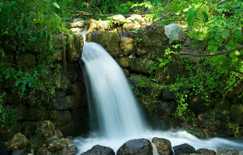
The Dan Stream watercourse – the source of the water is the gushing abundance of the Dan Spring, creating a strong current.
Paradise Springs – calmly babbling brooks creating channels along which the well-developed riverside forest offers charming and shady corners.
Pooh Bear Tree – a large, a hollow tree – an attraction for children.
Wading pools – shallow pools of refreshing, cool water alongside the hiking trail.
Tel Dan – one of the largest ancient tels in Israel, with the remains of a 5000 year old city. The height of the city’s development was during the Canaanite and Israelite periods.
Abraham Gate (the Canaanite Gate) – an ancient gate from the Canaanite period. The gate was made of mud bricks, and has been preserved to its full height of 7 m. Alongside the gate is a paved platform, reminiscent of biblical descriptions, and another gate from the Israelite period. Another noteworthy find is the ritual compound, harking back to the biblical story of the Golden Calf.
The Israelite Gate – another gate from the Israelite period, and a paved podium recalling descriptions from the Bible.
Ritual site – a ritual compound bringing to mind biblical stories of the Golden Calf.
The flour mill – an ancient flour mill preserved in its entirety, but not operational today.
Possibility of hiking.
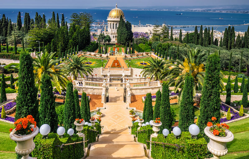
Haifa
Haifa is the third-largest city in Israel – after Jerusalem and Tel Aviv – with a population of 281,087 in 2017. The city of Haifa forms part of the Haifa metropolitan area, the second- or third-most populous metropolitan area in Israel. It is home to the Bahá'í World Centre, a UNESCO World Heritage Site and a destination for Bahá'í pilgrims.
Built on the slopes of Mount Carmel, the settlement has a history spanning more than 3,000 years. The earliest known settlement in the vicinity was Tell Abu Hawam, a small port city established in the Late Bronze Age (14th century BCE). In the 3rd century CE, Haifa was known as a dye-making center. Over the millennia, the Haifa area has changed hands: being conquered and ruled by the Canaanites, Israelites, Phoenicians, Persians, Hasmoneans, Romans, Byzantines, Arabs, Crusaders, Ottomans, and the British. Since the establishment of the State of Israel in 1948, the Haifa Municipality has governed the city.
As of 2016, the city is a major seaport located on Israel's Mediterranean coastline in the Bay of Haifa covering 63.7 square kilometres (24.6 sq mi). It lies about 90 kilometres (56 mi) north of Tel Aviv and is the major regional center of northern Israel. According to researcher Jonathan Kis-Lev, Haifa is considered a relative haven for coexistence between Jews and Arabs. Two respected academic institutions, the University of Haifa and the Technion, are located in Haifa. The city plays an important role in Israel's economy. It is home to Matam, one of the oldest and largest high-tech parks in the country; Haifa also owns the only underground rapid transit system located in Israel, known as the Carmelit. Haifa Bay is a center of heavy industry, petroleum refining and chemical processing. Haifa formerly functioned as the western terminus of an oil pipeline from Iraq via Jordan.
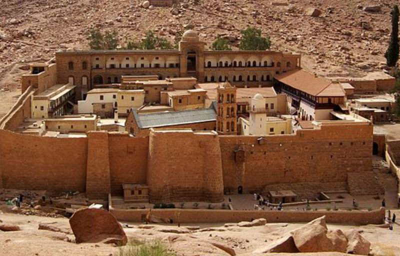
Sinai - St. Catherine Monastery
The Monastery of Saint Catherine and Mount Sinai (Jebel Musa) are two most famous sites in the 4,350 square kilometers Protectorate of Saint Catherine. Established in 1996, the Protectorate contains a wealth of cultural, natural and religious history. The unique high altitude desert ecosystem and the religious landscape are intertwined with local Bedouin life and culture.
St. Catherine’s Monastery has been one of the great centers of religious pilgrimage for over fifteen centuries. The site includes important religious and historical structures, a 6th century church reputed to sit on the site of the burning bush, and a library of ancient manuscripts and icons (second only to the collection of the Vatican).
Also located there are Arab mosaics, paintings and ornaments.
Inside the walls of the monastery lies the Fatimid Mosque.
The monastery itself was built by Emperor Justinian to protect monks in the region and to honor the site of the burning bush. Mount Sinai is believed to be the place where Moses received the Ten Commandments. It also has significance in Islam as the place where Mohammed’s horse rose to heaven.
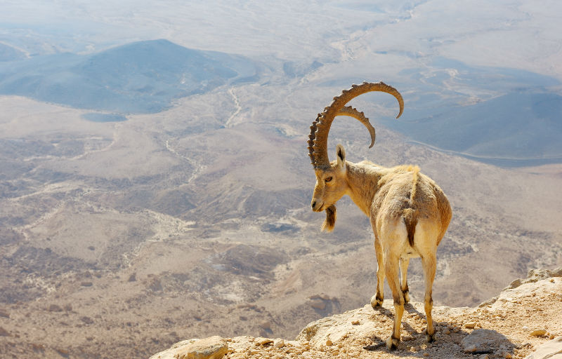
Ein Gedi
Ein Gedi, a desert oasis close to the Dead Sea, is an area of springs, waterfalls, polls and vegetation located in the arid desert. Wildlife is to be found in abundance.
It is believed that the oasis was first inhabited in the Chalcolithic Age (3000 BC); during the Byzantine period it was abandoned. There are Biblical references to Ein Gedi in the encounter between David and Saul (1 Samuel 24) and ‘ Song of Songs’ (1:14).
Things to see: the Nahal David Nature Reserve – a canyon overlooking the Dead Sea; Dodim Cave – Lovers Cave; Chalcolithic Temple – dedicated to worshipping the moon – Tel Goren – the first Israelite settlement; and the ruins of an ancient synagogue from the 2nd or 3rd century, boasting an interesting mosaic floor.
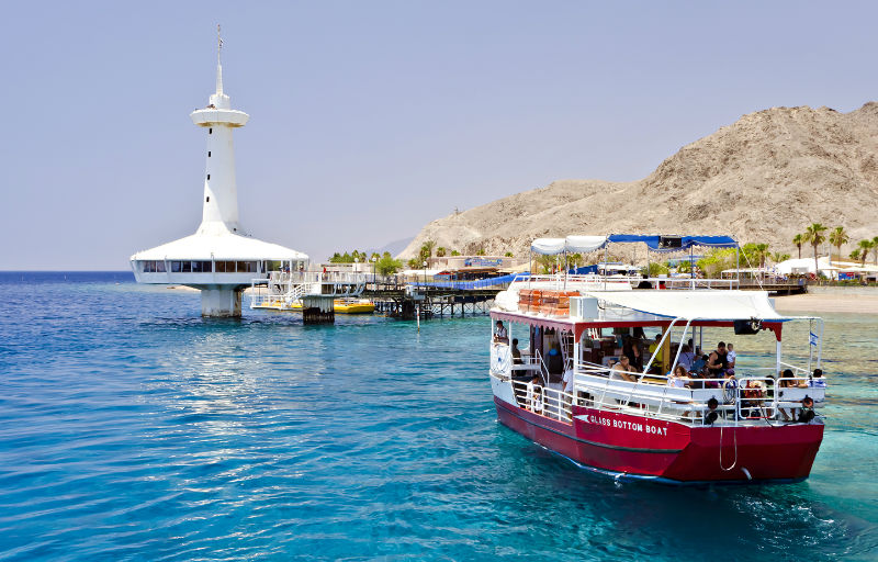
Eilat
Eilat is situated on the tip of Israel’s southern coast in the desert between Egypt and Jordan. The city is very modern with little historic interest apart from its dramatic and rapid growth from a small desert village, mainly because of Israel’s fear that Egypt and Jordan might try to close access to the Red Sea.
The city has a ‘tourist resort’ feel to it, offering large glitzy hotels with private beaches and water-sports. It also offers an array of different restaurants, cafes, bars, clubs and shops. It’s very popular place for a stop-over for travelers arriving from or leaving to neighboring countries.
Eilat, the desert oasis.
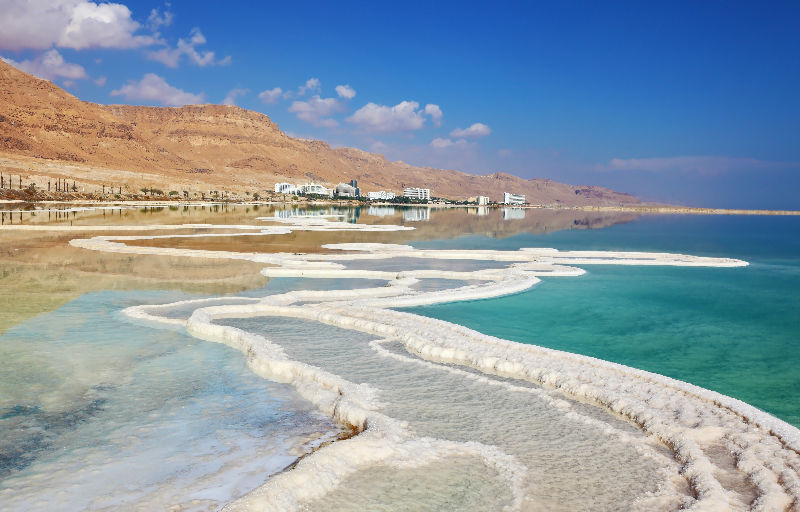
Dead Sea
Given that no living organisms can live in or around its waters, the Dead Sea was a forbidding place until 1848, when the US Navy explored it for the first time. However, it wasn’t until the British arrived 70 years later that real activity around the sea began.
The Dead Sea, located at the world’s lowest point, 400m below sea level, is 65km long and 18km across at the widest point – although its water levels fluctuate.
It is fed mainly by the Jordan River and enhanced by smaller rivers and springs. With no outlet for the water, and a high level of evaporation caused by the hot climate, the water has grown increasingly saline. The water’s salt content is about 30% - far higher than the 4% of ordinary sea water.
The Dead Sea is believed to have healing powers, relaxing nerves and clearing skin conditions and bronchial passages. Visitors to the Dead Sea receive an unforgettable experience as the high salt content makes sinking virtually impossible.
In the Bible, the Dead Sea is referred to as the Sea of Arabia, the Salt Sea and the Eastern Sea (Deuteronomy 3:17; Joshua 3:16; Numbers 34: 12; Ezekiel 47:18).
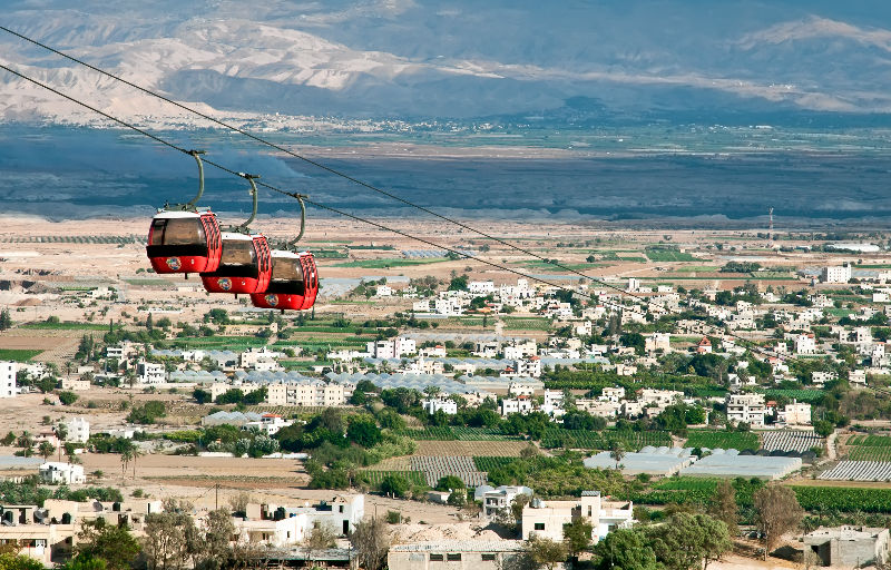
Jericho
Jericho, believed to be the oldest town in the world, dating back more than 10,000 years, is also the lowest town on earth, 260 meters below sea level. It is known as the ‘City of Palms’ because of its famous year-round production of fresh fruits and vegetables due to the moderate climate. The area of Jericho contains some of the most important historical sites and is frequently mentioned in the Bible. The Old Testament’s Book of Joshua tells how Jericho was the first town captured by the Israelites after they laid siege to it and bought down the walls with the blare of their priests’ trumpets.
The domestication of plants and animals and the invention of pottery took place in ancient Jericho 1,000 years before similar developments in Mesopotamia and Egypt, while the walls and towers of Jericho preceded the pyramids of Egypt by 4,000 years.
Ancient Jericho, known as the Tel of Jericho, is situated on a mound overlooking the Jericho oasis. Excavations have uncovered 23 layers of ancient civilizations dating back to 9,000 BC. Many structures are still visible today, including the oldest known stairs in the world, the oldest wall and the massive defense tower – dating back to 7,000 BC.
Places to visit: Hisham’s Palace, of importance to historians as it is believed to be one of the earliest forms of Islamic architecture, from the 7th century, showing Persian and Byzantine influences; an ancient synagogue with mosaic floor from the 5th of 6th century.
Jericho, the City of Palms.
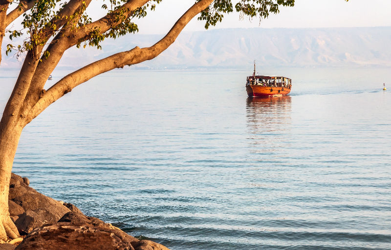
Sea of Galilee
The Sea of Galileeا, also called Lake Tiberias or Kinnereth, is a freshwater lake in Israel. It is the lowest freshwater lake on Earth and the second-lowest lake in the world (after the Dead Sea, a saltwater lake),at levels between 215 metres and 209 metres below sea level. It is approximately 53 km in circumference, about 21 km long, and 13 km wide. Its area is 166.7 km2 at its fullest, and its maximum depth is approximately 43 metres .The lake is fed partly by underground springs but its main source is the Jordan River, which flows through it from north to south and exits the Sea at the Degania Dam.
Tourism around the Sea of Galilee is an important economic branch. Historical and religious sites in the region draw both local and foreign tourists. The Sea of Galilee is an attraction for Christian pilgrims who visit Israel to see the places where Jesus performed miracles according to the New Testament, such as his walking on water, calming the storm and feeding the multitude. Alonzo Ketcham Parker, a nineteenth-century American traveler, called visiting the Sea of Galilee "a 'fifth gospel' which one read devoutly, his heart overflowing with quiet joy". In April 2011, Israel unveiled a 40-mile (64 km) hiking trail in Galilee for Christian pilgrims, called the "Jesus Trail". It includes a network of footpaths, roads and bicycle paths linking sites central to the lives of Jesus and his disciples. It ends at Capernaum on the shores of the Sea of Galilee, where Jesus expounded his teachings. Another key attraction is the site where the Sea of Galilee's water flows into the Jordan River, to which thousands of pilgrims from all over the world come to be baptized every year. Israel's most well-known open water swim race, the Kinneret Crossing, is held every year in September, drawing thousands of open water swimmers to participate in competitive and noncompetitive events. Other economic activities include fishing in the lake and agriculture, particularly bananas, dates, mangoes, grapes and olives in the fertile belt of land surrounding it.
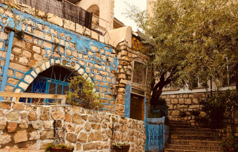
Safed
Safed, a town set in a hilltop retreat 900 meters above sea level, boasts an excellent climate and rich heritage of Jewish mysticism and an industrious artists’ colony.
The history of Safed dates back only 500 years to the beginning of the 16th century when Jews settled and established one of the largest settlements in Palestine. Later, in the 1920s and 1930s, clashes between local Arabs and Jews led to the Arabs being forced to leave the town.
Safed is one of four main holy cities for Jews in Israel and the occupied territories, together with Jerusalem, Hebron and Tiberias.
The old town consists of narrow cobblestone alleys presenting artists’ galleries, medieval synagogues and houses. The main attraction is the artists’ quarter, where Arab buildings and mosques have been turned into galleries and studios.
From the top of the mountain you can enjoy magnificent views east to the Golan, north to Mount Hermon and Lebanon, west to Mount Meron and the Amud Valley, and south to Tiberias and the Sea of Galilee.
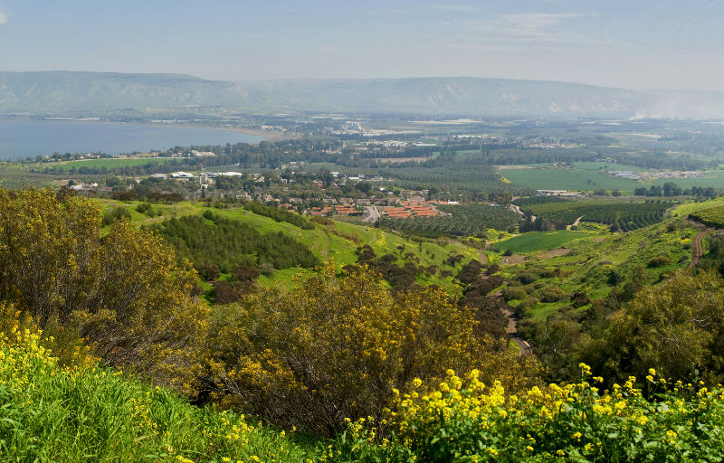
Golan Heights
The Golan Heights is a mountainous region complemented by beautiful wild flowers, flowing rivers and gushing waterfalls. Katzin, the capital of the Golan region, is a new town offering the Golan Archeological Museum, accommodation and restaurants.
The Golan was occupied by Israel during the Six-day, when all the Syrian inhabitants fled except for the local Druze inhabitants, who live in four villages in the region. The Druze carry on a traditional way of life, working the land, harvesting their crops – mainly apples – and raising goats, sheep and cows.
Archeological excavations have uncovered historical remains from the following periods: Canaanite, Roman, Byzantine, Crusader and Mameluke.
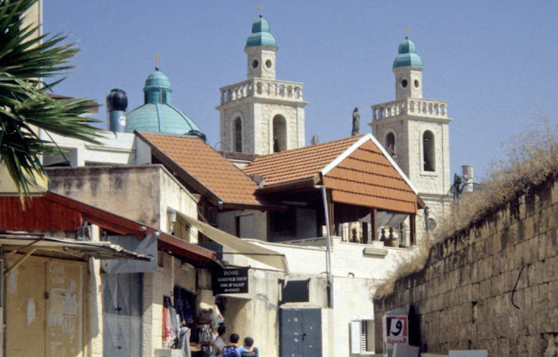
Cana
Cana is an Arab town north-east of Nazareth, on the road towards Tiberias. It is believed to be the site of Jesus’ first miracle, when he turned water into wine at a wedding reception (John 2:1-11). To commemorate this event Franciscan church exhibits a type of jar said to have contained the water Jesus turned into wine.
Cana was also the home of Nathanael, a disciple of Jesus (John 21:2). A Chapel now stands over the site of his house.
Caesarea
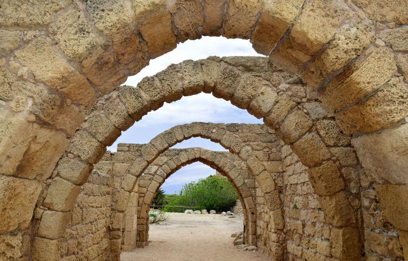
Caesarea is the city Herod the Great dedicated to Caesar Augustus more than 2,000 years ago. Today it is a fast-growing coastal resort and one of Israel’s major tourist destinations, attracting history lovers from around the world. Caesarea is also one of the top archeological sites in the country. The Roman city was built in 22 BC over the site of a Phoenician port and was home to the Roman governors of Judea, making it the local Roman capital.
Today it boasts the Roman remains of an aqueduct, hippodrome and amphitheatre. The hippodrome is now a rectangular ploughed field; however, you can still see what was once an arena capable of holding 20,000 spectators for chariot races. The amphitheater is a venue still very much in use, frequently staging concerts. The structure offers visitors a rare chance to appreciate the Romans’ building expertise and enjoy an important relic of their Empire. The aqueduct, near the sea, was built in the 2nd century and carried water from mountain springs to Caesarea. Also on view are Emperor Hadrian’s statue and two white, headless marble statues, thought to be of two Roman emperors, though of whom no one is certain.
To visit the Crusader city, surrounded by walls and open only to the sea, you enter through the East gate, built in the 12th century. In 1101 the Crusaders discovered what they believed to be the Holy Grail. Other sights: the church built over Caesar’s temple, and the mosque constructed by the Turks in the 19th century. There are also many shops and restaurants offering present-day entertainment.
Caesarea, the Roman capital of Israel.
Banias
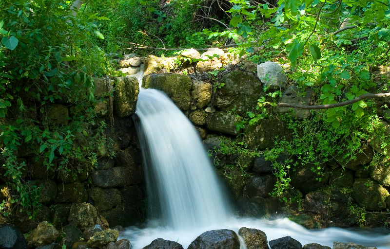
At the foot of Mount Hermon in the Golan (1150ft above sea level) lies Banias Nature Reserve. Its natural surroundings make it a beautiful location and it is possible just to walk by the River Hermon, coming across historic sites and ending at the Banias waterfall, the largest in the region and definitely worth seeing.
The Greek Seleucids conquered the area in 198 BC. Banias is the Arabic name of the Hellenic city of Paneas (the Greek god of herds and shepherds). The area was chosen by Philip, son of King Herod, as the capital of his kingdom of the Roman Empire, named Caesarea Philippi. In Biblical history, it is believed that Jesus visited the city, where he told his disciples that his church would be built on Peter, the rock (Matthew 16:13-20). Things to see: the ruins of shrines and temples, a Herodian building, the tomb of St. George (a Muslim saint), and Crusader ruins.
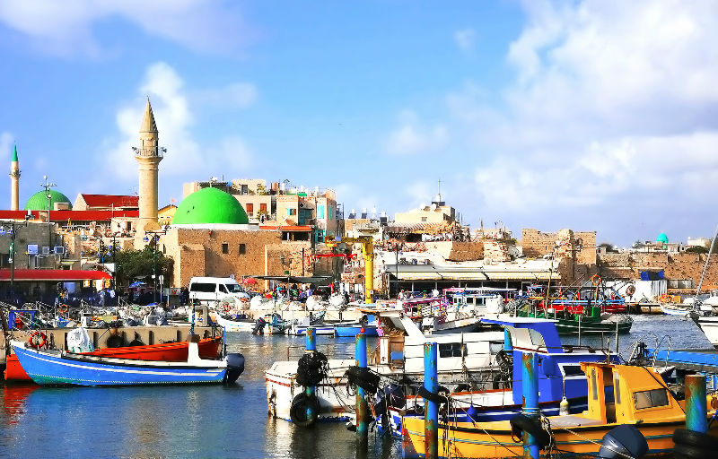
Acre
The city of Acre, or Akko, is one of the oldest cities in the world, inhabited since its founding in the period of Pharaoh Thutmose III (1504-1450 BC).
The city has been largely forgotten in modern times, and tourists are not catered for as they are in other cities in Israel. Akko has not benefited from rise of the global tourist industry, although it continues to attract tourists in large numbers. Today this coastal city is surrounded by what remains of the impressive sea walls defending the solid stone buildings that belong to the people of old Akko. The modern city is home to the country’s steel industry, while the once important Palestinian port is home to small fishing fleets. Fresh fish is readily available on all restaurant menus!
The history of Akko is chequered and colorful. The still-visible fortress and sea walls are the work of a Bedouin sheikh, Daher el-Omar, who made the city his capital in the mid-18th century after capturing it from its Ottoman rulers.
The Turks were finally driven from Palestine in 1918 by the British, who used the fortress as a prison. Today it is the site of the Underground Prisoners’ Memorial Museum, which also tells the history of Akko.
Other places of interest: The beautiful, large green-domed Al-Jazzar Mosque, built in 1781 during Ottoman rule. The subterranean Crusader City, a series of domed halls under present-day Akko. The Hammam al-Pasha, the well-preserved bath house of the mosque, used until the 1940’s, with marble floors and domed ceilings containing colored glass. Walking along the city walls, you are blessed with spectacular views of the sea and the city of Haifa, as well as unforgettable sunsets.
Akko, a place to observe centuries of history.
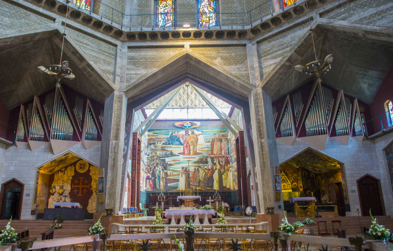
Nazareth
Nazareth is very important to the Christian faith, as it is widely believed to be the home of Mary and Joseph and the infant Jesus and home to some of the most important Christian shrines. Nazareth remains the center of the Christian mission movement in the Holy Land. It is also the largest Arab city in Israel, its population approximately half Christian and half Muslim. The 1950s saw the establishment of Nazareth Illit, a large Jewish industrial town which surrounds Nazareth.
The main places of interest, as in Jerusalem, are located in the old city dominated by its souq (market). The Basilica of Annunciation is believed to be the site where the Archangel Gabriel appeared to Mary to tell her that she was bearing Jesus, the son of God. On the lower floor is a sunken enclosure believed to be the traditional site of Mary’s house, while the upper level is still used for services, decorated with murals of Mary and the infant Jesus. Next to the Basilica are St. Joseph’s Church, where Joseph’s carpentry shop is believed to have stood, and the School of Jesus the Adolescent, built in 1918 in a mock-Gothic style. The Basilica is one of the most beautiful of Nazareth’s churches, offering fantastic views.
Next to the Greek Orthodox Church of St. Gabriel’s is Mary’s Well, where Mary collected water and where the Christian Orthodox believe the Annunciation took place. The water is reputed to this day to have healing power. The Greek Catholic Synagogue –Church is assumed in tradition to be where Jesus regularly prayed and later taught.
The old market is distinctive because of its winding steep streets and alleys with shops and market stalls. It is a working market with shops, cafes and restaurants enjoyed by locals and tourists alike. Enjoy a wonderfully memorable experience by visiting ‘Nazareth Village’, a museum recreating life in Nazareth as it was 2,000 years ago. The museum offers a unique window on the city’s history and the life of Jesus.
Nazareth has many places to stay from 5-star hotel to youth hostels. The city presents a good number of restaurants and cafes providing exceptional quality of food with typically Arab hospitality.
Nazareth, a place not to be missed.
Sephoris, a village near Nazareth, is considered the birth place of Mary’s parents, Joachim and Anna.